Home » Portfolio » Suburb Insights Platform for Property Selection
Project deteils
Case Study Summary
Industry
Real estate
Client
Real estate agency
Project duration
6 months
Location
Australia
Team
2 FTE
Services
Full-stack web development, GIS integration, Data scraping and API integration,
Responsive design
Project overview
An Australian real estate agency partnered with GIS Art to develop a platform that simplifies property selection for future homeowners. Designed for international and interstate migrants, the solution centralizes data from multiple sources to provide insights into schools, safety zones, housing prices, and more, enabling informed, quick decisions.
Сhallenge
The client struggled to provide potential homebuyers with accurate and comprehensive suburb insights on infrastructure, safety zones, and housing prices, to simplify property selection.
The data was scattered across various sources, making aggregation into a unified platform a complex task. Maintaining up-to-date suburb and property details in real time was essential but posed technical challenges.
The platform also needed to present complex information, such as school proximity, safety zones, and housing data, in a user-friendly way. Ensuring fast performance and responsiveness across devices was crucial to delivering a seamless user experience.
Our Approach
Solution
Data Aggregation and API Integration
In the first month, we focused on aggregating data from multiple sources, including Google Maps, open-source APIs, and paid services. This step ensured accurate and up-to-date suburb and property data.
Core Functionality with GIS
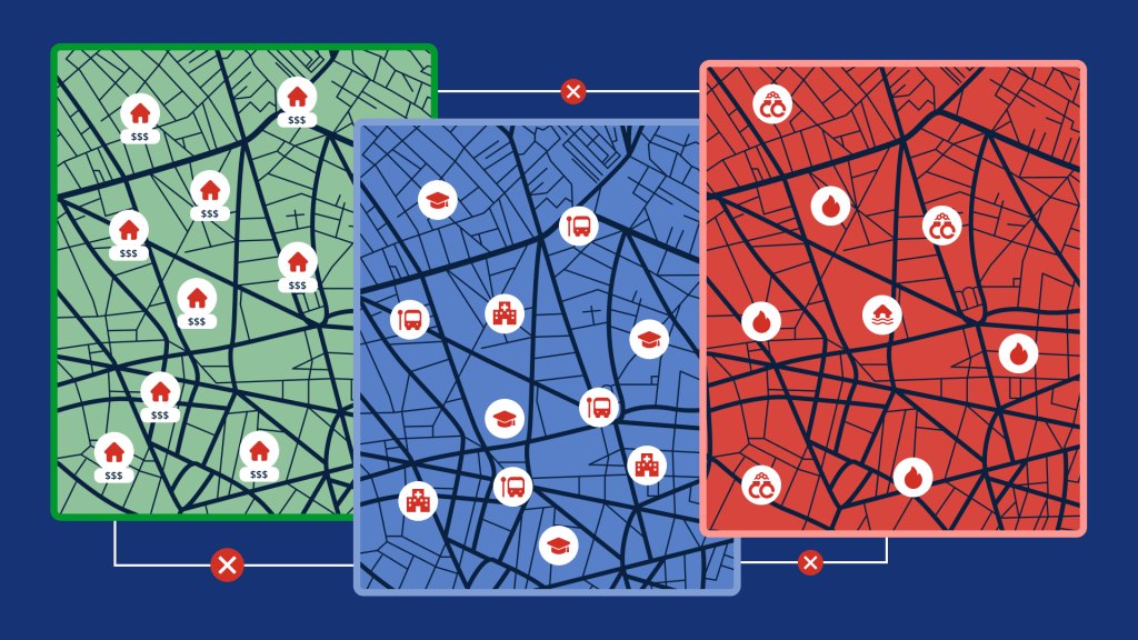
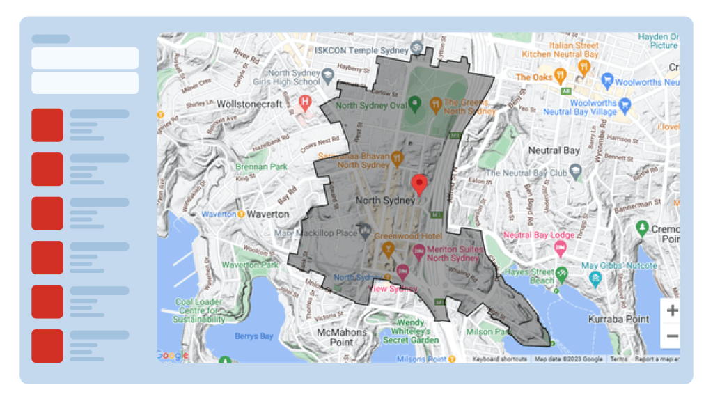
Over the next 3 months, we implemented the core functionality with GIS features such as an interactive map to visualize key points of interest, like schools, hospitals, shops, and safety zones, search for an address or suburb, displaying suburb data, and comparison of suburbs.
Responsive UI and other Improvements
In the final 2 months, we made the UI fully responsive to ensure seamless usability across desktops, tablets, and mobile devices. Additionally, some improvements were made based on customer feedback.
Main Features
Data Integration: Collecting geospatial data from multiple reliable sources into one database
Data Visualisation: Interactive map with overlays for infrastructure, safety zones, points of interest, etc.
Search for an Address or Suburb, with autocomplete
Suburb/Property Info: Displaying data of the selected suburb/property
Comparison of Suburbs: Report with data of the compared suburbs
Responsive Design: Ensures consistent usability across devices.
The platform was built on a modular and scalable architecture using the MVC pattern, enabling seamless integration of new features and data sources. This design keeps the platform running smoothly, even when handling large and constantly changing datasets.
Infrastructure
Deployed on a secure, scalable cloud environment, the platform leverages AWS for hosting and PostgreSQL for efficient GIS data handling. Docker was used for streamlined deployment, ensuring faster updates.
Business Outcomes
The Suburban Insights platform delivered measurable results, transforming how homebuyers access and analyze suburb data:
Enhanced Decision Making: Users can instantly access detailed suburb insights, significantly reducing the time needed to research property locations.
Insights for Real Estate Investments: The client has received valuable insights based on the user interests for different suburbs
Decreased Data Management Expenses: Automaticscrapingofgeospatialdata from multiple sources reduced the time needed for updating data by more than 10 times, and ensures that users have up-to-date data.
Scalability: The platform’s architecture supports future expansion to include additional regions and more detailed analyses.
Market Engagement: The platform continues to attract users, providing valuable insights.
Our solution made it easier for homebuyers to make informed decisions and improved the overall user experience. It also helped the client establish themselves as a trusted source for reliable real estate insights.
Client Review
Contact us
Start the Conversation Today
Looking to optimize your business with GIS solutions?
As the CTO of GIS Art, I can help boost operations and enhance customer experience through efficient GIS implementation. Unravel patterns and actionable insights derived from spatial data. With over 15 years of software development expertise in Healthcare, Real Estate, Transportation, Logistics, and beyond, we can unlock the potential of your business.